
1952 Map of Nulato D-4
USGS Topo · Published 1957About this map
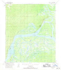
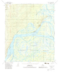
The Koyukuk settlement sits at a critical fluvial junction where the Koyukuk River meets the Yukon River. This 1952 topographic study, derived from aerial photography, illustrates a complex aquatic landscape of shifting channels, including Holtilyet Slough and Patsy Slough. A network of smaller waterways like Squirrel Creek and Negotsena Creek drain the surrounding terrain, while Koyukuk Mountain provides a prominent landmark overlooking the confluence.
Find a feature on this map
24 named features on this map. Tap any name to fly to it.
Don’t see what you’re looking for? This feature index may not catch every label — zoom into the map to look around manually.
Map Details
Editions of this 1952 Nulato D-4 Map
3 editions found
Other maps of this area

1945 · Nulato
USGS Topo · 1:250,000

1951 · Nulato
USGS Topo · 1:250,000

1951 · Kateel River
USGS Topo · 1:250,000

1952 · Nulato D-3
USGS Topo · 1:63,360

1952 · Nulato D-5
USGS Topo · 1:63,360

1952 · Nulato C-3
USGS Topo · 1:63,360

1952 · Nulato C-4
USGS Topo · 1:63,360

1952 · Kateel River A-4
USGS Topo · 1:63,360

1952 · Kateel River A-3
USGS Topo · 1:63,360

1952 · Nulato C-5
USGS Topo · 1:63,360