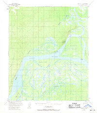
1952 Map of Nulato D-4
USGS Topo · Published 1971About this map
Koyukuk Mountain overlooks the strategic confluence of the Koyukuk River and the Yukon River, a landscape defined by an intricate network of braided channels and shifting waterways. In the early 1950s, the area's infrastructure was primarily aeronautical and historic, centered on the Koyukuk Landing Strip and a nearby Cem. The map documents the remnants of 19th-century communication with the Abandoned Telegraph Line cutting through the northern terrain, signaling the transition from gold-rush era connectivity to post-war isolation.
Find a feature on this map
22 named features on this map. Tap any name to fly to it.
Don’t see what you’re looking for? This feature index may not catch every label — zoom into the map to look around manually.
Map Details
Editions of this 1952 Nulato D-4 Map
3 editions found
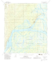
Other maps of this area

1945 · Nulato
USGS Topo · 1:250,000

1951 · Nulato
USGS Topo · 1:250,000

1951 · Kateel River
USGS Topo · 1:250,000

1952 · Nulato D-3
USGS Topo · 1:63,360

1952 · Nulato D-5
USGS Topo · 1:63,360

1952 · Nulato C-3
USGS Topo · 1:63,360

1952 · Nulato C-4
USGS Topo · 1:63,360

1952 · Kateel River A-4
USGS Topo · 1:63,360

1952 · Nulato D-4
USGS Topo · 1:63,360

1952 · Kateel River A-3
USGS Topo · 1:63,360