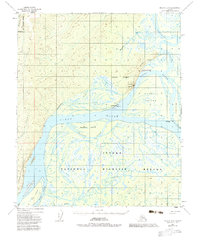
1952 Map of Nulato D-4
USGS Topo · Published 1983About this map
Koyukuk stands at the strategic confluence where the Koyukuk River meets the Yukon River, serving as a vital focal point in this 1952 aerial-based survey. The landscape is defined by an intricate network of waterways and shifting islands, including Koyukuk Island and Megotsol Island, separated by channels such as Holtilyet Slough. The settlement itself features essential mid-century infrastructure, including a Landing Strip, Tanks, and the Koyukuk Azimuth Mark, reflecting its role as a transportation and navigation hub in the Alaskan interior.
Find a feature on this map
29 named features on this map. Tap any name to fly to it.
Don’t see what you’re looking for? This feature index may not catch every label — zoom into the map to look around manually.
Map Details
Editions of this 1952 Nulato D-4 Map
3 editions found
Other maps of this area

1945 · Nulato
USGS Topo · 1:250,000

1951 · Nulato
USGS Topo · 1:250,000

1951 · Kateel River
USGS Topo · 1:250,000

1952 · Nulato D-3
USGS Topo · 1:63,360

1952 · Nulato D-5
USGS Topo · 1:63,360

1952 · Nulato C-3
USGS Topo · 1:63,360

1952 · Nulato C-4
USGS Topo · 1:63,360

1952 · Kateel River A-4
USGS Topo · 1:63,360

1952 · Nulato D-4
USGS Topo · 1:63,360

1952 · Kateel River A-3
USGS Topo · 1:63,360