
1952 Map of Nulato A-2
USGS Topo · Published 1957About this map
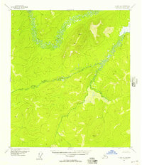
The Yuki River and its major tributary, the East Fork Yuki River, dominate this interior Alaskan landscape as it was documented in the early 1950s. The map captures a high-elevation wilderness defined by prominent survey markers, including Vabm Kite 2247 and Vabm Bare 2116. These triangulation stations represent the critical early mapping efforts by the Geological Survey to chart the Yukon-Koyukuk region using 1952 aerial photography. The drainage patterns and topographic relief shown here reflect an environment entirely devoid of roads or permanent settlements at the time of the survey, where the river systems served as the primary natural corridors through the varied terrain, punctuated only by peaks like Vabm Quartz 1573.
Find a feature on this map
6 named features on this map. Tap any name to fly to it.
Don’t see what you’re looking for? This feature index may not catch every label — zoom into the map to look around manually.
Map Details
Editions of this 1952 Nulato A-2 Map
2 editions found
Other maps of this area

1945 · Nulato
USGS Topo · 1:250,000

1951 · Ophir
USGS Topo · 1:250,000

1951 · Nulato
USGS Topo · 1:250,000

1952 · Nulato B-2
USGS Topo · 1:63,360

1952 · Nulato B-1
USGS Topo · 1:63,360

1952 · Nulato B-3
USGS Topo · 1:63,360

1952 · Nulato A-3
USGS Topo · 1:63,360
1952 · Nulato A-1
USGS Topo · 1:63,360

1952 · Nulato
USGS Topo · 1:250,000
1953 · Nulato B-1
USGS Topo · 1:63,360