
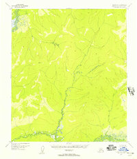
1952 Map of Nulato B-1
USGS Topo · Published 1957About this map
Fork River dominates this mid-century topographical study, its complex, winding path creating a dense network of oxbows and marshlands as it moves through the Interior Alaskan wilderness. This specific survey, derived from 1952 aerial photography, captures the intricate hydrology of the Fork River basin during a period when much of this region remained unmapped on the ground. The absence of roads, trails, or human settlements emphasizes the isolation of the Yukon-Koyukuk terrain during the early 1950s. The map serves as a primary record of the natural drainage patterns and elevation profiles of the high ridges and low-lying river valleys, providing an essential resource for understanding the undisturbed geography of the Alaskan Interior before modern development or environmental shifts altered the waterway's course.
Find a feature on this map
1 named feature on this map. Tap any name to fly to it.
Don’t see what you’re looking for? This feature index may not catch every label — zoom into the map to look around manually.
Map Details
Editions of this 1952 Nulato B-1 Map
This is the sole edition of this map. No revisions or reprints were ever made.
Other maps of this area

1945 · Nulato
USGS Topo · 1:250,000

1951 · Nulato
USGS Topo · 1:250,000

1951 · Ruby
USGS Topo · 1:250,000

1952 · Nulato C-1
USGS Topo · 1:63,360

1952 · Nulato B-2
USGS Topo · 1:63,360

1952 · Nulato C-2
USGS Topo · 1:63,360

1952 · Ruby B-6
USGS Topo · 1:63,360

1952 · Nulato A-2
USGS Topo · 1:63,360

1952 · Ruby A-6
USGS Topo · 1:63,360
1952 · Nulato A-1
USGS Topo · 1:63,360