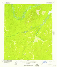
1952 Map of Nulato A-2
USGS Topo · Published 1957About this map
The serpentine course of the Yuki River dominates this interior Alaska landscape, captured during a 1950s survey of the Nulato A-2 region. The terrain is defined by its complex drainage network, where the East Fork Yuki River carves a significant path through the hills. This document records the wilderness in its mid-century state, when topographic detail was established through 1952 aerial photography and 1955 multiplex methods. Geodetic markers and triangulation stations indicate the high points used for early navigation and mapping, including VABM Kede 2247 and VABM Bare 2116. The absence of roads or trails emphasizes the isolation of this Yukon-Koyukuk territory, providing a benchmark of the natural geography before later human infrastructure reached these interior drainages.
Find a feature on this map
6 named features on this map. Tap any name to fly to it.
Don’t see what you’re looking for? This feature index may not catch every label — zoom into the map to look around manually.
Map Details
Editions of this 1952 Nulato A-2 Map
2 editions found
Other maps of this area

1945 · Nulato
USGS Topo · 1:250,000

1951 · Ophir
USGS Topo · 1:250,000

1951 · Nulato
USGS Topo · 1:250,000

1952 · Nulato B-2
USGS Topo · 1:63,360

1952 · Nulato B-1
USGS Topo · 1:63,360

1952 · Nulato A-2
USGS Topo · 1:63,360

1952 · Nulato B-3
USGS Topo · 1:63,360

1952 · Nulato A-3
USGS Topo · 1:63,360
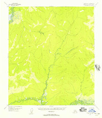
1952 · Nulato A-1
USGS Topo · 1:63,360

1952 · Nulato
USGS Topo · 1:250,000