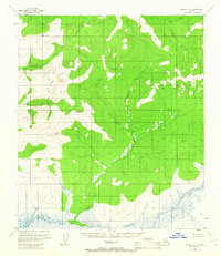
1953 Map of Nulato A-4
USGS Topo · Published 1967About this map
The Kaiyuh Mountains dominate this 1953 interior landscape, where the Khotol River and its numerous tributaries carve through the upland terrain. This Bureau of Land Management study reveals an era of unsurveyed and unmarked land lines, where the geographic orientation relied entirely on natural watercourses and prominent peaks like Khotol Mountain. A complex network of drainage basins, including Colorado Creek, California Creek, and Minnesota Creek, flows through the central valleys toward the lower marshlands.
Find a feature on this map
12 named features on this map. Tap any name to fly to it.
Don’t see what you’re looking for? This feature index may not catch every label — zoom into the map to look around manually.
Map Details
Editions of this 1953 Nulato A-4 Map
This is the sole edition of this map. No revisions or reprints were ever made.
Other maps of this area

1945 · Nulato
USGS Topo · 1:250,000

1951 · Ophir
USGS Topo · 1:250,000

1951 · Nulato
USGS Topo · 1:250,000

1952 · Nulato A-5
USGS Topo · 1:63,360

1952 · Nulato A-4
USGS Topo · 1:63,360

1952 · Nulato B-5
USGS Topo · 1:63,360

1952 · Nulato B-3
USGS Topo · 1:63,360

1952 · Nulato B-4
USGS Topo · 1:63,360

1952 · Nulato A-3
USGS Topo · 1:63,360

1952 · Nulato
USGS Topo · 1:250,000