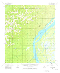
1952 Map of Nulato B-6
USGS Topo · Published 1976About this map
The Yukon River dominates this interior landscape, carving a wide path past the settlement of Kaltag. This mid-century survey reveals a corridor of transport and communication along the riverbank, including the Abandoned Telegraph Line and the Kaltag CAA Station. Smaller outposts and river stops like Fourmile Camp and Rodokakat (Alex's) dot the eastern bank, while the western side rises toward landmarks such as Notakok Mountain and Tamantaloi Hill.
Find a feature on this map
21 named features on this map. Tap any name to fly to it.
Don’t see what you’re looking for? This feature index may not catch every label — zoom into the map to look around manually.
Map Details
Editions of this 1952 Nulato B-6 Map
2 editions found
Other maps of this area

1945 · Nulato
USGS Topo · 1:250,000

1948 · Norton Bay
USGS Topo · 1:250,000

1951 · Nulato
USGS Topo · 1:250,000

1951 · Norton Bay
USGS Topo · 1:250,000

1952 · Nulato A-5
USGS Topo · 1:63,360

1952 · Nulato B-6
USGS Topo · 1:63,360

1952 · Norton Bay B-1
USGS Topo · 1:63,360

1952 · Nulato B-5
USGS Topo · 1:63,360

1952 · Nulato C-6
USGS Topo · 1:63,360

1952 · Nulato C-5
USGS Topo · 1:63,360