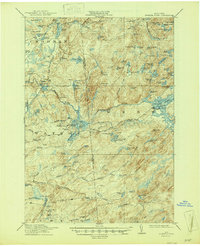
1915 Map of Number Four
USGS Topo · Published 1947About this map
Oswegatchie River and its multiple branches define this intricate hydrologic landscape on the border of Lewis and Herkimer counties. The map, based on surveys from 1910-1912, reveals an area shaped by both natural drainage and early industrial water management. While the terrain is dominated by a dense network of ponds and lakes such as Lyons Lake and Upper South Pond, the hand of man is visible in infrastructure like the Soft Maple Dam and Beech Dam. These features, along with the Silver Mine Dam, suggest a history of managing water power in a region where elevation changes are marked by landmarks like Eagle Falls and Stillwater Mtn. Geographers R.B. Marshall and Frank Sutton oversaw this detailed record of the wilderness just before more modern developments reached this part of the Adirondacks.
Find a feature on this map
97 named features on this map. Tap any name to fly to it.
Don’t see what you’re looking for? This feature index may not catch every label — zoom into the map to look around manually.
Map Details
Editions of this 1915 Number Four Map
5 editions found
Other maps of this area

1901 · Old Forge
USGS Topo · 1:62,500

1903 · Big Moose
USGS Topo · 1:62,500

1905 · Port Leyden
USGS Topo · 1:62,500

1907 · Port Leyden
USGS Topo · 1:62,500

1911 · Lowville
USGS Topo · 1:62,500

1912 · Number Four
USGS Topo · 1:62,500

1912 · Mc Keever
USGS Topo · 1:62,500

1913 · Lowville
USGS Topo · 1:62,500

1913 · Lake Bonaparte
USGS Topo · 1:62,500

1915 · Number Four
USGS Topo · 1:62,500