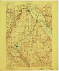
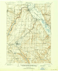
1905 Map of Nunda
USGS Topo · Published 1912About this map
Mount Morris anchors this early twentieth-century survey of the Genesee Valley, serving as a vital rail hub where the Erie RR (Mt Morris Br) meets the Delaware Lackawanna and Western RR. The landscape is defined by the winding course of the Genesee River and the significant presence of Sonyea P O Craig Colony situated along the Pennsylvania RR (Rochester Division).
Find a feature on this map
61 named features on this map. Tap any name to fly to it.
Don’t see what you’re looking for? This feature index may not catch every label — zoom into the map to look around manually.
Map Details
Editions of this 1905 Nunda Map
6 editions found
Other maps of this area

1901 · Honeoye
USGS Topo · 1:62,500

1902 · Wayland
USGS Topo · 1:62,500

1904 · Wayland
USGS Topo · 1:62,500

1904 · Batavia
USGS Topo · 1:62,500

1904 · Caledonia
USGS Topo · 1:62,500

1904 · Honeoye
USGS Topo · 1:62,500

1905 · Portage
USGS Topo · 1:62,500

1905 · Nunda
USGS Topo · 1:62,500

1906 · Angelica
USGS Topo · 1:62,500

1915 · Hornell
USGS Topo · 1:62,500