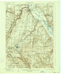
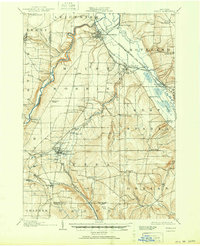
1905 Map of Nunda
USGS Topo · Published 1934About this map
The Genesee River carves a deep valley through this landscape, defining the topography of Livingston County at the turn of the century. The map illustrates a dense network of early 20th-century transportation, where the Erie R R and the Pennsylvania R R converge at points like Nunda Junc. A notable cultural feature is the Sonyea P O Craig Colony, a significant institutional site of the era located near the banks of Keshequa Creek.
Find a feature on this map
58 named features on this map. Tap any name to fly to it.
Don’t see what you’re looking for? This feature index may not catch every label — zoom into the map to look around manually.
Map Details
Editions of this 1905 Nunda Map
6 editions found
Other maps of this area

1901 · Honeoye
USGS Topo · 1:62,500

1902 · Wayland
USGS Topo · 1:62,500

1904 · Wayland
USGS Topo · 1:62,500

1904 · Batavia
USGS Topo · 1:62,500

1904 · Caledonia
USGS Topo · 1:62,500

1904 · Honeoye
USGS Topo · 1:62,500

1905 · Portage
USGS Topo · 1:62,500

1905 · Nunda
USGS Topo · 1:62,500

1906 · Angelica
USGS Topo · 1:62,500

1915 · Hornell
USGS Topo · 1:62,500