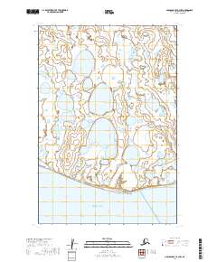
2019 Map of Nushagak Bay B-3 NW
USGS Topo · Published 2019About this map
Cape Constantine marks the southern terminus of the Nushagak Peninsula, a distinctive landform defined by an intricate network of wetlands and small coastal lakes. This remote landscape fronts the northern reaches of Bristol Bay, where the shoreline interaction with the tides creates a shifting, saturated terrain. The map reveals the township and range system at the edge of the Dillingham Census Area, illustrating how the Public Land Survey System imposes a grid over a region dominated by water and low-lying vegetation. While devoid of permanent settlements or roads, the area is historically significant as a transition point for maritime navigation and seasonal activities within the larger bay ecosystem.
Find a feature on this map
9 named features on this map. Tap any name to fly to it.
Don’t see what you’re looking for? This feature index may not catch every label — zoom into the map to look around manually.
Map Details
Editions of this 2019 Nushagak Bay B-3 NW Map
This is the sole edition of this map. No revisions or reprints were ever made.
Other maps of this area

1945 · Nushagak Bay
USGS Topo · 1:250,000

1948 · Nushagak Bay C-4 And C-5
USGS Topo · 1:63,360

1949 · Nushagak Bay
USGS Topo · 1:250,000

1950 · Nushagak Bay B-4
USGS Topo · 1:63,360

1950 · Nushagak Bay C-3
USGS Topo · 1:63,360

1950 · Nushagak Bay C-4 And C-5
USGS Topo · 1:63,360
1950 · Nushagak Bay B-3
USGS Topo · 1:63,360

1951 · Nushagak Bay
USGS Topo · 1:250,000

1964 · Nushagak Bay
USGS Topo · 1:250,000
2019 · Nushagak Bay C-4 SE
USGS Topo · 1:25,000