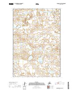
2019 Map of Nushagak Bay C-3 SW
USGS Topo · Published 2019About this map
The Nushagak Peninsula dominates this 2019 survey, characterized by an intricate network of wetlands and small lakes in the Dillingham Census Area. The landscape is defined by its transition between tundra and aquatic systems, where the Tunuig River meanders across the northern reaches of the quadrangle. This area remains largely unsettled, with the survey focusing on the natural hydrography and elevation data of the remote Alaskan coast.
Find a feature on this map
6 named features on this map. Tap any name to fly to it.
Don’t see what you’re looking for? This feature index may not catch every label — zoom into the map to look around manually.
Map Details
Editions of this 2019 Nushagak Bay C-3 SW Map
This is the sole edition of this map. No revisions or reprints were ever made.
Other maps of this area

1945 · Nushagak Bay
USGS Topo · 1:250,000

1948 · Nushagak Bay C-4 And C-5
USGS Topo · 1:63,360

1949 · Nushagak Bay
USGS Topo · 1:250,000

1950 · Nushagak Bay B-4
USGS Topo · 1:63,360

1950 · Nushagak Bay C-3
USGS Topo · 1:63,360

1950 · Nushagak Bay C-4 And C-5
USGS Topo · 1:63,360
1950 · Nushagak Bay B-3
USGS Topo · 1:63,360

1951 · Nushagak Bay
USGS Topo · 1:250,000

1964 · Nushagak Bay
USGS Topo · 1:250,000
2019 · Nushagak Bay C-4 SE
USGS Topo · 1:25,000