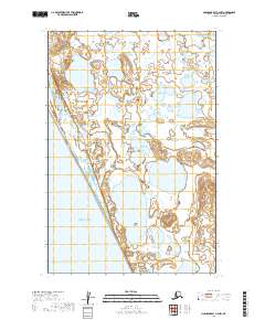
2019 Map of Nushagak Bay C-4 NW
USGS Topo · Published 2019About this map
Bristol Bay defines the southwestern edge of this coastal landscape, where the tides of southwestern Alaska meet a complex system of lowland tundra and wetlands. This 2019 survey documents the intricate hydrography of the region, most notably the large expanse of Kikertalik Lake. The terrain is characterized by a dense network of smaller unnamed ponds and marshy depressions typical of the Dillingham Census Area. The lack of road infrastructure or named settlements on this sheet highlights the wilderness character of the Bristol Bay drainage, where the landscape is shaped primarily by glacial and alluvial processes rather than human development. The township and range lines, including t17s r60w and t18s r61w, provide the primary grid for navigating this otherwise trackless territory.
Find a feature on this map
8 named features on this map. Tap any name to fly to it.
Don’t see what you’re looking for? This feature index may not catch every label — zoom into the map to look around manually.
Map Details
Editions of this 2019 Nushagak Bay C-4 NW Map
This is the sole edition of this map. No revisions or reprints were ever made.
Other maps of this area

1945 · Nushagak Bay
USGS Topo · 1:250,000

1948 · Nushagak Bay D-4
USGS Topo · 1:63,360

1948 · Nushagak Bay C-4 And C-5
USGS Topo · 1:63,360

1949 · Nushagak Bay
USGS Topo · 1:250,000

1950 · Nushagak Bay C-4 And C-5
USGS Topo · 1:63,360

1950 · Nushagak Bay D-5
USGS Topo · 1:63,360

1951 · Nushagak Bay
USGS Topo · 1:250,000

1952 · Nushagak Bay D-4
USGS Topo · 1:63,360

1964 · Nushagak Bay
USGS Topo · 1:250,000
2019 · Nushagak Bay C-4 SE
USGS Topo · 1:25,000