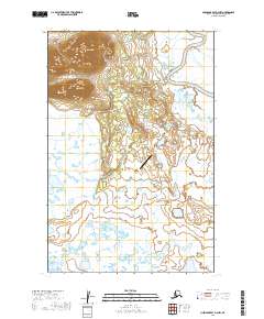
2019 Map of Nushagak Bay D-3 NW
USGS Topo · Published 2019About this map
Manokotak serves as the primary hub in this southwestern Alaska landscape, where the settlement is situated along the winding course of the Weary River. The terrain is defined by a vast network of wetlands and tundra, punctuated to the northwest by the prominent elevation of Acorn Peak. This survey illustrates a modern infrastructure layout designed for remote accessibility, centered on the Manokotak Airport and a small network of terrestrial connectors including the Weary River Access Road and Manokotak Heights Road. The map provides a detailed view of the township and range boundaries that organize this section of the Dillingham Census Area, showing the relationship between the small community and the expansive riverine environment that supports local subsistence and transport.
Find a feature on this map
12 named features on this map. Tap any name to fly to it.
Don’t see what you’re looking for? This feature index may not catch every label — zoom into the map to look around manually.
Map Details
Editions of this 2019 Nushagak Bay D-3 NW Map
This is the sole edition of this map. No revisions or reprints were ever made.
Other maps of this area

1945 · Nushagak Bay
USGS Topo · 1:250,000

1948 · Nushagak Bay D-4
USGS Topo · 1:63,360

1948 · Nushagak Bay D-3
USGS Topo · 1:63,360

1949 · Nushagak Bay
USGS Topo · 1:250,000

1951 · Dillingham
USGS Topo · 1:250,000

1951 · Goodnews
USGS Topo · 1:250,000

1951 · Nushagak Bay
USGS Topo · 1:250,000

1952 · Nushagak Bay D-3
USGS Topo · 1:63,360

1952 · Nushagak Bay D-4
USGS Topo · 1:63,360

1952 · Dillingham A-8
USGS Topo · 1:63,360