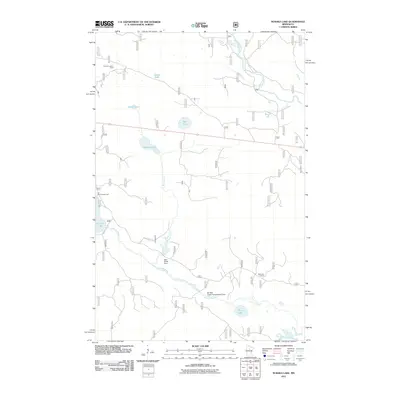
2011 Map of Nushka Lake
USGS Topo · Published 2011About this map
The Mississippi River winds through the northeast corner of this north-central Minnesota landscape, which is defined by an intricate network of glacial lakes and managed waterways. In this early 21st-century survey, the prominence of fire management and recreation is evident through the inclusion of the Nushka Lookout Tower and Mud Lake Lookout, along with the Six Mile Campground situated near the shores of Sixmile Lake. Water control structures like the Bear Brook Dam and Six Mile Creek Impoundment Dam indicate how the local hydrology was modified to support the surrounding wetlands. This region, characterized by extensive forest routes like Forest Rte 2346 and Forest Rte 2127, provides a clear view of the wilderness infrastructure used to maintain the water levels of Nushka Lake and the Leech Lake River basin.
Find a feature on this map
18 named features on this map. Tap any name to fly to it.
Don’t see what you’re looking for? This feature index may not catch every label — zoom into the map to look around manually.
Map Details
Editions of this 2011 Nushka Lake Map
This is the sole edition of this map. No revisions or reprints were ever made.
Other maps of this area

1954 · Bemidji
USGS Topo · 1:250,000

1954 · Hibbing
USGS Topo · 1:250,000

1957 · Bemidji
USGS Topo · 1:250,000

1957 · Hibbing
USGS Topo · 1:250,000

1958 · Bemidji
USGS Topo · 1:250,000

1958 · Hibbing
USGS Topo · 1:250,000

1964 · Hibbing
USGS Topo · 1:250,000

1970 · Ball Club
USGS Topo · 1:24,000
1970 · Little Ball Club Lake
USGS Topo · 1:24,000

1971 · Nushka Lake
USGS Topo · 1:24,000