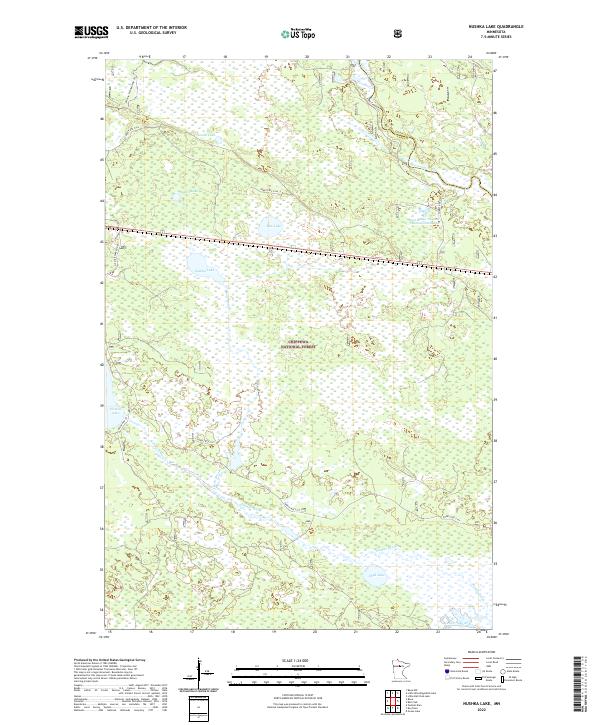
2022 Map of Nushka Lake
USGS Topo · Published 2022About this map
Chippewa National Forest dominates this northern landscape, where a dense network of wetlands and waterways defines the Northwoods geography. The upper Mississippi River meanders through the northeast corner, just downstream from where it exits Lake Winnibigoshish. To the south, the Leech Lake River flows along the bottom edge of the sheet, connected by a complex system of drainage including Sixmile Brook and Bear Brook. The area is dotted with numerous glacial lakes, including the namesake Nushka Lake, the larger Rice Lake, and Sixmile Lake to the west. Human activity is primarily limited to forest management and recreation, indicated by the network of service roads such as Forest Rte 2164 and the Winnie Snowmobile Trl. The presence of the West-Banks-Number-One Impoundment near the Itasca County line highlights modern hydrological management within this protected timberland.
Find a feature on this map
23 named features on this map. Tap any name to fly to it.
Don’t see what you’re looking for? This feature index may not catch every label — zoom into the map to look around manually.
Map Details
Editions of this 2022 Nushka Lake Map
This is the sole edition of this map. No revisions or reprints were ever made.
Other maps of this area

1954 · Bemidji
USGS Topo · 1:250,000

1954 · Hibbing
USGS Topo · 1:250,000

1957 · Bemidji
USGS Topo · 1:250,000

1957 · Hibbing
USGS Topo · 1:250,000

1958 · Bemidji
USGS Topo · 1:250,000

1958 · Hibbing
USGS Topo · 1:250,000

1964 · Hibbing
USGS Topo · 1:250,000

1970 · Ball Club
USGS Topo · 1:24,000
1970 · Little Ball Club Lake
USGS Topo · 1:24,000

1971 · Nushka Lake
USGS Topo · 1:24,000