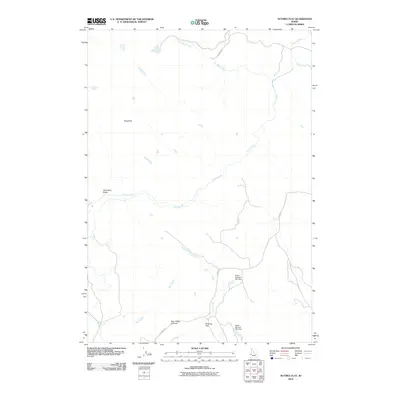
2010 Map of Nutmeg Flat
USGS Topo · Published 2010About this map
Nutmeg Flat sits at a geographic crossroads in this part of Washington County, where the high-desert terrain of Bear Creek Summit meets a complex network of seasonal drainages. The landscape is defined by its water management and grazing infrastructure, notably featuring the Swain Number One Dam and Swain Number Two Dam which anchor the local hydrology. This 2010 survey illustrates the sparse but critical transportation network, including S Crane Rd and Johnson Ln, which connect remote ranching interests to the wider region. Significant natural landmarks such as Sugarloaf and the ominous Dead Man Gulch provide distinct orientation points for those studying the area's physical history. The drainage patterns of Crane Creek and Star Butte Creek reveal the essential role of water in this semi-arid Idaho environment, shaping both the cattle-rearing economy and the layout of the few established tracks.
Find a feature on this map
13 named features on this map. Tap any name to fly to it.
Don’t see what you’re looking for? This feature index may not catch every label — zoom into the map to look around manually.
Map Details
Editions of this 2010 Nutmeg Flat Map
This is the sole edition of this map. No revisions or reprints were ever made.
Other maps of this area

1897 · Weiser
USGS Topo · 1:125,000

1952 · Weiser Cove
USGS Topo · 1:24,000

1953 · Mann Creek
USGS Topo · 1:62,500

1955 · Baker
USGS Topo · 1:250,000

1957 · Crane Creek Reservoir
USGS Topo · 1:62,500

1959 · Baker
USGS Topo · 1:250,000
1970 · Paddock Valley Reservoir
USGS Topo · 1:24,000
1970 · Holland Gulch
USGS Topo · 1:24,000

1980 · Weiser
USGS Topo · 1:100,000
1986 · Crane Creek Reservoir
USGS Topo · 1:24,000