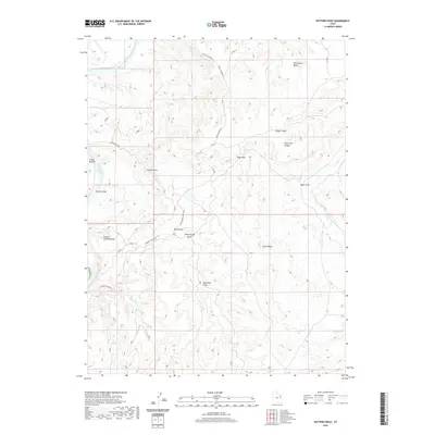
2020 Map of Nutters Hole
USGS Topo · Published 2020About this map
The Green River curves through the western edge of this landscape, carving out the namesake Nutters Hole and Ranch Bottom within the high desert terrain of Uintah County. The topography is defined by a complex network of eroded formations and dry washes, most notably the deeply textured area known as The Wrinkles and the expansive Sumner Amphitheater. This modern survey illustrates how primitive roads like The Wrinkles Rd and Tabyago Canyon Rd navigate the difficult geography between Wild Horse Bench and the various drainage systems such as Alger Draw and Rock Spring Draw. The map documents a sparsely settled region where travel is dictated by the natural breaks in the canyon walls, from Kings Canyon to Peter Post Canyon, reflecting the enduring character of the Utah backcountry.
Find a feature on this map
22 named features on this map. Tap any name to fly to it.
Don’t see what you’re looking for? This feature index may not catch every label — zoom into the map to look around manually.
Map Details
Editions of this 2020 Nutters Hole Map
This is the sole edition of this map. No revisions or reprints were ever made.
Other maps of this area

1885 · East Tavaputs
USGS Topo · 1:250,000

1953 · Nutters Hole
USGS Topo · 1:62,500

1953 · Firewater Canyon
USGS Topo · 1:62,500

1956 · Grand Junction
USGS Topo · 1:250,000

1959 · Grand Junction
USGS Topo · 1:250,000

1960 · Grand Junction
USGS Topo · 1:250,000

1962 · Grand Junction
USGS Topo · 1:250,000

1964 · Grand Junction
USGS Topo · 1:250,000

1965 · Grand Junction
USGS Topo · 1:250,000
1966 · Agency Draw NW
USGS Topo · 1:24,000