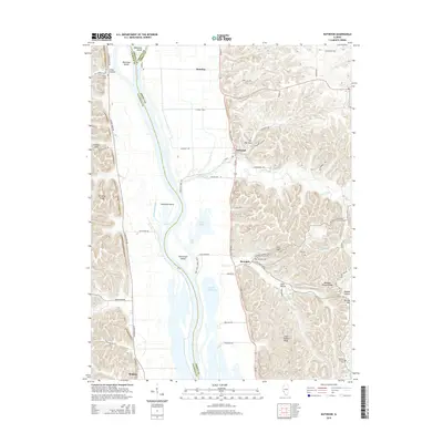
2015 Map of Nutwood
USGS Topo · Published 2015About this map
The Illinois River corridor dominates this landscape, serving as the border between Calhoun, Greene, and Jersey counties. The river's western bank is characterized by a complex network of islands and backwaters, including Twelvemile Island, Helmbold Island, and the expansive Upper Stump Lake. To the east, the terrain rises sharply from the floodplain into a series of prominent ridges and hollows. Features such as The Narrows and Saint Andrew Ridge define the local topography, while numerous small hollows like Lead Hollow and Simpson Hollow cut through the bluffs. Small communities such as Nutwood and Rosedale are tucked against these hills along the Great River Road. Genealogists will find several burial sites preserved on this 2015 edition, including Rosedale Cem, Smith Cem, and the remote Meadow Branch Cem situated on the eastern heights near Meadow Branch Ridge.
Find a feature on this map
64 named features on this map. Tap any name to fly to it.
Don’t see what you’re looking for? This feature index may not catch every label — zoom into the map to look around manually.
Map Details
Editions of this 2015 Nutwood Map
This is the sole edition of this map. No revisions or reprints were ever made.
Other maps of this area

1903 · O'Fallon
USGS Topo · 1:125,000

1927 · St. Charles
USGS Topo · 1:62,500

1930 · Hardin
USGS Topo · 1:62,500

1930 · Jerseyville
USGS Topo · 1:62,500

1931 · Brussels
USGS Topo · 1:62,500

1933 · Jerseyville
USGS Topo · 1:62,500

1933 · Saint Charles
USGS Topo · 1:62,500

1934 · Hardin
USGS Topo · 1:62,500

1938 · Hardin
USGS Topo · 1:62,500

1939 · Brussels
USGS Topo · 1:62,500