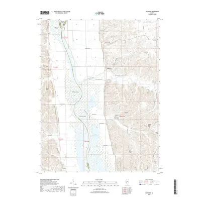
2018 Map of Nutwood
USGS Topo · Published 2018About this map
Illinois River wetlands and the complex alluvial floodplain of the central Mississippi valley dominate this landscape, where the river winds between Twelvemile Island and Helmbold Island. The eastern bluffs rise sharply from the water, creating distinctive local landmarks such as The Narrows and Dug Hill. This region is defined by its seasonal hydrology, where expansive backwaters like The Glades, Flat Lake, and Upper Stump Lake create a sprawling network of marshlands and sloughs between the river and the rising timbered ridges.
Find a feature on this map
78 named features on this map. Tap any name to fly to it.
Don’t see what you’re looking for? This feature index may not catch every label — zoom into the map to look around manually.
Map Details
Editions of this 2018 Nutwood Map
This is the sole edition of this map. No revisions or reprints were ever made.
Other maps of this area

1903 · O'Fallon
USGS Topo · 1:125,000

1927 · St. Charles
USGS Topo · 1:62,500

1930 · Hardin
USGS Topo · 1:62,500

1930 · Jerseyville
USGS Topo · 1:62,500

1931 · Brussels
USGS Topo · 1:62,500

1933 · Jerseyville
USGS Topo · 1:62,500

1933 · Saint Charles
USGS Topo · 1:62,500

1934 · Hardin
USGS Topo · 1:62,500

1938 · Hardin
USGS Topo · 1:62,500

1939 · Brussels
USGS Topo · 1:62,500