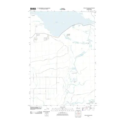
2011 Map of O'Sullivan Dam
USGS Topo · Published 2011About this map
O'Sullivan Dam serves as the primary anchor for this landscape, holding back the expansive waters of Potholes Reservoir in Grant County. The area is defined by an intricate network of managed water systems, including the Frenchman Hills Wasteway and Goose Lake Wasteway, which direct flow through a series of natural and man-made basins. To the south, the terrain transitions into a chain of smaller water bodies such as Lower Goose Lake, Black Lake, and Hutchinson Lake, all following the natural course of Lower Crab Creek.
Find a feature on this map
54 named features on this map. Tap any name to fly to it.
Don’t see what you’re looking for? This feature index may not catch every label — zoom into the map to look around manually.
Map Details
Editions of this 2011 O'Sullivan Dam Map
This is the sole edition of this map. No revisions or reprints were ever made.
Other maps of this area

1912 · Moses Lake
USGS Topo · 1:62,500

1923 · Corfu
USGS Topo · 1:62,500

1923 · Wheeler
USGS Topo · 1:62,500

1924 · Othello
USGS Topo · 1:62,500

1925 · Wheeler
USGS Topo · 1:62,500

1951 · Corfu
USGS Topo · 1:62,500

1953 · Walla Walla
USGS Topo · 1:250,000

1953 · Ritzville
USGS Topo · 1:250,000

1954 · Soda Lake
USGS Topo · 1:24,000

1954 · Othello
USGS Topo · 1:24,000