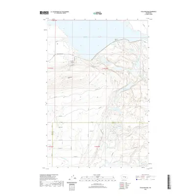
2020 Map of O'Sullivan Dam
USGS Topo · Published 2020About this map
O'Sullivan Dam serves as the focal point of this arid Washington landscape, holding back the sprawling Potholes Reservoir at the edge of the Frenchman Hills. The area is defined by a sophisticated water management system crucial for the regional agricultural economy, featuring the Potholes Canal, the Goose Lake Wasteway, and the Crab Creek Lateral. South of the dam, the terrain descends toward the Royal Slope, where a chain of smaller water bodies including Upper Goose Lake, Lower Goose Lake, and Black Lake provides a stark contrast to the surrounding high desert. The map also delineates the boundary between Grant Co and Adams Co, showing how local infrastructure like Kulm Rd SE and W Phillips Rd connects these isolated water features and wildlife areas like Marsh Unit One.
Find a feature on this map
43 named features on this map. Tap any name to fly to it.
Don’t see what you’re looking for? This feature index may not catch every label — zoom into the map to look around manually.
Map Details
Editions of this 2020 O'Sullivan Dam Map
This is the sole edition of this map. No revisions or reprints were ever made.
Other maps of this area

1912 · Moses Lake
USGS Topo · 1:62,500

1923 · Corfu
USGS Topo · 1:62,500

1923 · Wheeler
USGS Topo · 1:62,500

1924 · Othello
USGS Topo · 1:62,500

1925 · Wheeler
USGS Topo · 1:62,500

1951 · Corfu
USGS Topo · 1:62,500

1953 · Walla Walla
USGS Topo · 1:250,000

1953 · Ritzville
USGS Topo · 1:250,000

1954 · Soda Lake
USGS Topo · 1:24,000

1954 · Othello
USGS Topo · 1:24,000