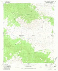
1981 Map of O Bar O Canyon West
USGS Topo · Published 1981About this map
The Continental Divide winds through this high-altitude landscape of western New Mexico, crossing through the northern reaches of the Gila National Forest. This 1981 survey documents a terrain defined by deep drainage systems like La Jolla Canyon and Mesa Redonda Canyon that cut through the prominent O Bar O Mountain. The map reveals a land managed for ranching and forest operations, characterized by a complex network of water catchments including Reliable Tank, Mesa Redonda Tank, and Horse Camp Tank. Towards the south, the topography rises into the Elk Mountains, where South Elk Road provides one of the few established routes through the timbered heights. This record of the backcountry captures the essential water infrastructure required for survival and industry in the high desert before modern technological shifts altered traditional land use patterns.
Find a feature on this map
24 named features on this map. Tap any name to fly to it.
Don’t see what you’re looking for? This feature index may not catch every label — zoom into the map to look around manually.
Map Details
Editions of this 1981 O Bar O Canyon West Map
This is the sole edition of this map. No revisions or reprints were ever made.
Other maps of this area

1911 · Alum Mountain
USGS Topo · 1:125,000

1913 · Alum Mountain
USGS Topo · 1:125,000

1918 · Pelona
USGS Topo · 1:125,000

1954 · Clifton
USGS Topo · 1:250,000

1957 · Clifton
USGS Topo · 1:250,000

1958 · Clifton
USGS Topo · 1:250,000

1962 · Clifton
USGS Topo · 1:250,000
1963 · Loco Mountain
USGS Topo · 1:24,000
1963 · Pitchfork Canyon
USGS Topo · 1:24,000
1965 · Canyon Creek Mountains
USGS Topo · 1:24,000