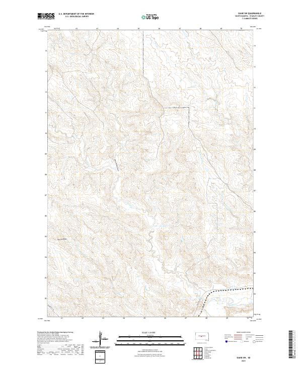
2021 Map of Oahe SW
USGS Topo · Published 2021About this map
Murray Butte stands as a prominent landmark in this portion of Stanley County, overlooking a landscape defined by an intricate drainage system feeding toward the southern edge of the sheet. The southern boundary is dominated by the course of the Bad River, which is paralleled by Bad River Rd, a primary corridor through this ranching country. The terrain is marked by significant topographical variation, including Government Draw and several seasonal watercourses such as Broken Neck Cr and Tomahawk Cr. Evidence of modern rural life is centered around Princes Ranch and a network of local tracks like Bunkhouse Rd and Cactus Pl. This survey illustrates the persistent importance of water access and high-ground landmarks in managing the wide-open spaces of central South Dakota.
Find a feature on this map
18 named features on this map. Tap any name to fly to it.
Don’t see what you’re looking for? This feature index may not catch every label — zoom into the map to look around manually.
Map Details
Editions of this 2021 Oahe SW Map
This is the sole edition of this map. No revisions or reprints were ever made.
Other maps of this area

1937 · Oahe
USGS Topo · 1:62,500

1951 · Van Metre
USGS Topo · 1:24,000

1953 · Teton
USGS Topo · 1:24,000

1953 · Oahe SW
USGS Topo · 1:24,000

1953 · Wendte
USGS Topo · 1:24,000

1953 · Wendte NE
USGS Topo · 1:24,000

1954 · Pierre
USGS Topo · 1:250,000

1958 · Pierre
USGS Topo · 1:250,000
1973 · Willow Creek Butte
USGS Topo · 1:24,000

1980 · Princes Ranch
USGS Topo · 1:25,000