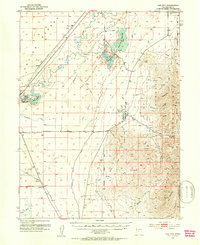
1951 Map of Oak City
USGS Topo · Published 1953About this map
Oak City serves as the primary settlement in this early 1950s survey, positioned where the high country of the Fishlake National Forest meets the arid Sevier Desert. The complex irrigation landscape of the eastern Great Basin is highly visible here, marked by the Central Utah Canal, Taylors Canal, and a series of storage facilities including Fool Creek Reservoir No 1 and the Delta Reservoir. These waterworks contrast sharply with the Oak Creek Sinks and the Sand Dunes further west. Transportation and commerce are represented by the Union Pacific railroad line, which passes through the small stations of Strong and Harding. Above the town, the terrain rises into the Canyon Range, featuring the Oak Creek Ranger Sta and several local landmarks like Partridge Mtn and Blue Mountain.
Find a feature on this map
60 named features on this map. Tap any name to fly to it.
Don’t see what you’re looking for? This feature index may not catch every label — zoom into the map to look around manually.
Map Details
Editions of this 1951 Oak City Map
3 editions found
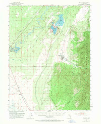
Other maps of this area

1885 · Sevier Desert
USGS Topo · 1:250,000

1951 · Oak City
USGS Topo · 1:62,500

1952 · Scipio North
USGS Topo · 1:62,500

1953 · Delta
USGS Topo · 1:250,000

1958 · Delta
USGS Topo · 1:250,000

1962 · Delta
USGS Topo · 1:250,000

1962 · Lynndyl
USGS Topo · 1:62,500

1962 · Holden
USGS Topo · 1:62,500

1962 · Delta
USGS Topo · 1:62,500

1967 · Champlin Peak
USGS Topo · 1:24,000