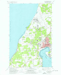
1973 Map of Oak Harbor
USGS Topo · Published 1977About this map
Whidbey Island Naval Air Station Ault Field dominates the northern landscape of this Whidbey Island study, illustrating the significant military footprint in the early 1970s. The bustling settlement of Oak Harbor is shown with its grid of avenues, including 700 Ave East and E Pioneer Way, alongside local institutions like Oak Harbor High School and Olympic View School. The surrounding rural landscape is a mix of agricultural valley land and coastal features, from the heights of Monkey Hill to the wetlands of Waterloo Marsh. Historical land use is visible in the numerous borrow pits and gravel pits scattered near the runways. Smaller communities and family-named landmarks like Swantown and Hastie Lake provide points of interest for genealogists tracing the development of Island County during this era of growth.
Find a feature on this map
60 named features on this map. Tap any name to fly to it.
Don’t see what you’re looking for? This feature index may not catch every label — zoom into the map to look around manually.
Map Details
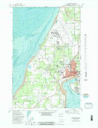
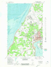
Editions of this 1973 Oak Harbor Map
3 editions found
Other maps of this area

1939 · Port Townsend
USGS Topo · 1:62,500

1939 · Coupeville
USGS Topo · 1:62,500

1943 · Richardson
USGS Topo · 1:62,500

1943 · Deception Pass
USGS Topo · 1:62,500

1951 · Deception Pass
USGS Topo · 1:62,500

1953 · Coupeville
USGS Topo · 1:24,000

1953 · Camano
USGS Topo · 1:24,000

1953 · Port Townsend North
USGS Topo · 1:24,000

1957 · Richardson
USGS Topo · 1:62,500

1957 · Victoria
USGS Topo · 1:250,000