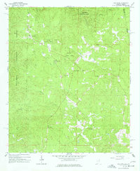
1966 Map of Oak Level
USGS Topo · Published 1977About this map
Talladega National Forest dominates this section of eastern Alabama, where the landscape is defined by the headwaters of several key creeks along the Georgia state line. The settlement of Oak Level sits at a crossroads in the northwest, serving as a focal point for a rural community characterized by its numerous country churches and small cemeteries. These spiritual and social landmarks, such as Mars Hill Ch and New Coldwater Ch, are scattered throughout the wooded terrain, often accompanied by family burial grounds like Cherry Grove Cem. The map reveals a dispersed settlement pattern typical of the mid-20th century in Cleburne County, where life followed the winding paths of Muscadine Creek and Wallace Creek. This survey captures the area before modern development, preserving the locations of sites like Piney Woods and Pilgrims Rest Ch for local historians and genealogists.
Find a feature on this map
22 named features on this map. Tap any name to fly to it.
Don’t see what you’re looking for? This feature index may not catch every label — zoom into the map to look around manually.
Map Details
Editions of this 1966 Oak Level Map
3 editions found
Other maps of this area

1889 · Tallapoosa
USGS Topo · 1:125,000

1892 · Tallapoosa
USGS Topo · 1:125,000

1897 · Tallapoosa
USGS Topo · 1:125,000

1900 · Anniston
USGS Topo · 1:125,000

1953 · Atlanta
USGS Topo · 1:250,000

1957 · Atlanta
USGS Topo · 1:250,000

1958 · Atlanta
USGS Topo · 1:250,000

1965 · Tallapoosa South
USGS Topo · 1:24,000

1966 · Tallapoosa North
USGS Topo · 1:24,000
1966 · Benedict
USGS Topo · 1:24,000