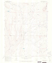
1964 Map of Oakbrush Ridge
USGS Topo · Published 1967About this map
San Juan National Forest lands dominate this mid-century survey, centered on the confluence of high-altitude water systems and early mountain recreation infrastructure. The Piedra River and its major tributary, Williams Creek, serve as the primary geographical anchors, supporting established sites like the Piedra Guard Station and several seasonal camping areas including Bridge Campground and Upper Piedra Campground.
Find a feature on this map
61 named features on this map. Tap any name to fly to it.
Don’t see what you’re looking for? This feature index may not catch every label — zoom into the map to look around manually.
Map Details
Editions of this 1964 Oakbrush Ridge Map
4 editions found

Other maps of this area

1905 · San Cristobal
USGS Topo · 1:125,000

1907 · San Cristobal
USGS Topo · 1:125,000

1924 · Pagosa Springs
USGS Topo · 1:125,000

1927 · Pagosa Springs
USGS Topo · 1:125,000

1945 · Durango
USGS Topo · 1:250,000

1953 · Durango
USGS Topo · 1:250,000

1954 · Durango
USGS Topo · 1:250,000

1961 · Durango
USGS Topo · 1:250,000

1963 · Durango
USGS Topo · 1:250,000
1964 · Chris Mountain
USGS Topo · 1:24,000