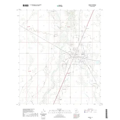
2020 Map of Oakdale
USGS Topo · Published 2020About this map
Oakdale serves as the central hub of this Allen Parish landscape, situated at the confluence of several vital waterways and a grid of residential streets. The Calcasieu River and its meandering tributaries, such as Cherrywinche Cr and Baptiste Cr, define the drainage patterns west of the town center. The map reveals a dense concentration of burial sites that provide a roadmap for local genealogical research, ranging from the large Oakdale Cem and Resthaven Cem to smaller grounds like Cryer Cem and the Sacred Heart Cem. Transportation and infrastructure are anchored by the Allen Parish Airport to the south and a network of family-named rural roads including Louis Laird Rd and Tom Quave Rd, illustrating the transition from the structured urban layout of the city to the surrounding piney woods and creek bottoms.
Find a feature on this map
85 named features on this map. Tap any name to fly to it.
Don’t see what you’re looking for? This feature index may not catch every label — zoom into the map to look around manually.
Map Details
Editions of this 2020 Oakdale Map
This is the sole edition of this map. No revisions or reprints were ever made.
Other maps of this area

1935 · Beaver
USGS Topo · 1:31,680

1935 · Pawnee
USGS Topo · 1:31,680

1935 · Oakdale
USGS Topo · 1:31,680

1942 · Oakdale
USGS Topo · 1:62,500

1947 · Foley
USGS Topo · 1:31,680

1947 · Steep Gully
USGS Topo · 1:31,680

1947 · Pine Chapel
USGS Topo · 1:31,680

1947 · Bond
USGS Topo · 1:31,680

1947 · Elizabeth
USGS Topo · 1:31,680

1948 · Elizabeth
USGS Topo · 1:24,000