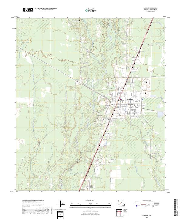
2024 Map of Oakdale
USGS Topo · Published 2024About this map
Oakdale serves as the central hub of this Allen Parish landscape, situated at the confluence of several vital watercourses including the Calcasieu River and Cherrywinche Creek. The town's grid is established north of the SOWELA Technical Community College Oakdale Site, with numerous neighborhood cemeteries such as Oakdale Cem and Sacred Heart Cem reflecting the deep generational roots of the local community.
Find a feature on this map
87 named features on this map. Tap any name to fly to it.
Don’t see what you’re looking for? This feature index may not catch every label — zoom into the map to look around manually.
Map Details
Editions of this 2024 Oakdale Map
This is the sole edition of this map. No revisions or reprints were ever made.
Other maps of this area

1935 · Beaver
USGS Topo · 1:31,680

1935 · Pawnee
USGS Topo · 1:31,680

1935 · Oakdale
USGS Topo · 1:31,680

1942 · Oakdale
USGS Topo · 1:62,500

1947 · Foley
USGS Topo · 1:31,680

1947 · Steep Gully
USGS Topo · 1:31,680

1947 · Pine Chapel
USGS Topo · 1:31,680

1947 · Bond
USGS Topo · 1:31,680

1947 · Elizabeth
USGS Topo · 1:31,680

1948 · Elizabeth
USGS Topo · 1:24,000