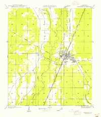
1955 Map of Oakdale
USGS Topo · Published 1955About this map
Oakdale serves as a critical rail and transit hub in Allen Parish on this mid-century survey, situated at the junction of the Missouri Pacific Railroad and the Gulf Colorado and Santa Fe Railroad. The town’s economic foundations are clearly visible through the extensive network of timber-related infrastructure, including a Logging Railroad, a State Railroad, and several sections of Old Logging Grade winding through the surrounding woods.
Find a feature on this map
17 named features on this map. Tap any name to fly to it.
Don’t see what you’re looking for? This feature index may not catch every label — zoom into the map to look around manually.
Map Details
Editions of this 1955 Oakdale Map
This is the sole edition of this map. No revisions or reprints were ever made.
Other maps of this area

1935 · Beaver
USGS Topo · 1:31,680

1935 · Pawnee
USGS Topo · 1:31,680

1935 · Oakdale
USGS Topo · 1:31,680

1942 · Oakdale
USGS Topo · 1:62,500

1947 · Foley
USGS Topo · 1:31,680

1947 · Steep Gully
USGS Topo · 1:31,680

1947 · Pine Chapel
USGS Topo · 1:31,680

1947 · Bond
USGS Topo · 1:31,680

1947 · Elizabeth
USGS Topo · 1:31,680

1948 · Elizabeth
USGS Topo · 1:24,000