
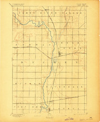
1894 Map of Oakes
USGS Topo · Published 1894About this map
The James River meanders through the heart of this North Dakota landscape, carving out the wide James River Valley as it flows south toward the border. This 1892 survey by Van. H. Manning documents a critical junction of early prairie commerce, where four major rail lines converge near the growing hub of Oakes. The settlement pattern follows these iron arteries, with small rail-side outposts like Glover to the north and Ludden near the southern edge. The map captures the Dakota territory's rapid development shortly after statehood, showing a grid of townships including Norway and Port Emma. While much of the terrain is characterized by the river's floodplain and the drainage of Bear Creek, the specific placements of Port Emma and Hillsdale provide precise coordinates for family historians and researchers interested in the first generation of permanent prairie settlement.
Find a feature on this map
21 named features on this map. Tap any name to fly to it.
Don’t see what you’re looking for? This feature index may not catch every label — zoom into the map to look around manually.
Map Details
Editions of this 1894 Oakes Map
2 editions found
Other maps of this area

1894 · La Moure
USGS Topo · 1:62,500

1894 · Hecla
USGS Topo · 1:62,500

1894 · Savo
USGS Topo · 1:62,500

1894 · Fullerton
USGS Topo · 1:62,500

1895 · Lamoure
USGS Topo · 1:125,000

1896 · Columbia
USGS Topo · 1:125,000

1918 · La Moure
USGS Topo · 1:125,000

1952 · Glover
USGS Topo · 1:24,000

1952 · Oakes
USGS Topo · 1:24,000

1952 · Crete
USGS Topo · 1:24,000