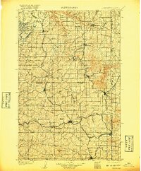
1905 Map of Oakesdale
USGS Topo · Published 1917About this map
Oakesdale stands as a central hub in the heart of the Palouse during the early twentieth century, surrounded by a high-density network of railroads essential to the region's grain-growing economy. Lines of the Northern Pacific RR, the Oregon RR and Navigation Co, and the Spokane and Inland RR crisscross the landscape, connecting established towns like Rosalia, Tekoa, and Garfield to the larger markets of the Pacific Northwest. This survey, conducted just after the turn of the century, captures the intricate transition from the rugged drainage of Hangman Creek and Rock Creek to the undulating agricultural hills dominated by landmarks like Steptoe Butte and Tekoa Mountain. The map detail reveals the importance of rail sidings and small stations, such as Summit Siding and Seltice, in supporting the dispersed farmstead communities that defined the Washington-Idaho borderlands before modern highway development.
Find a feature on this map
55 named features on this map. Tap any name to fly to it.
Don’t see what you’re looking for? This feature index may not catch every label — zoom into the map to look around manually.
Map Details
Editions of this 1905 Oakesdale Map
3 editions found
Other maps of this area

1901 · Spokane
USGS Topo · 1:125,000

1903 · Oakesdale
USGS Topo · 1:125,000

1903 · Rathdrum
USGS Topo · 1:125,000

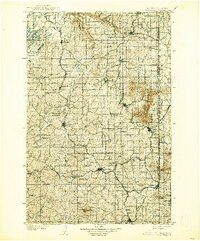
1905 · Oakesdale
USGS Topo · 1:125,000

1910 · Pullman
USGS Topo · 1:125,000

1943 · Medical Lake
USGS Topo · 1:62,500

1949 · Greenacres
USGS Topo · 1:62,500

1950 · Spokane SE
USGS Topo · 1:24,000

1950 · Endicott
USGS Topo · 1:62,500

1950 · Spokane SW
USGS Topo · 1:24,000