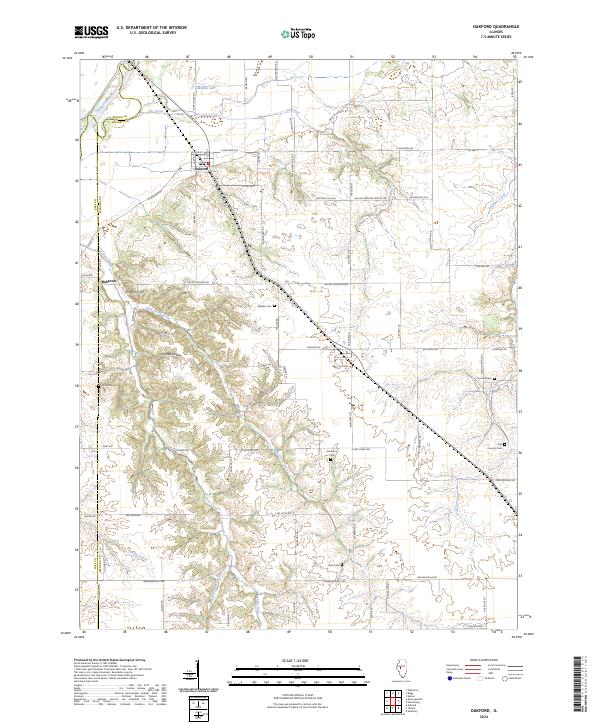
2024 Map of Oakford
USGS Topo · Published 2024About this map
Oakford and the nearby cluster of Bobtown define the local settlement pattern at the northern edge of Menard County, where the landscape transitions from the Sangamon River bottomlands into a series of deeply etched drainages. The area is notable for its high density of family and community burial grounds, including the Watkins Cem and Atterberry Cem, which provide essential points of reference for genealogists. The terrain is marked by distinctive named depressions and rises such as Mott Hollow, Millseed Hollow, and Kingfisher Hill.
Find a feature on this map
51 named features on this map. Tap any name to fly to it.
Don’t see what you’re looking for? This feature index may not catch every label — zoom into the map to look around manually.
Map Details
Editions of this 2024 Oakford Map
This is the sole edition of this map. No revisions or reprints were ever made.
Other maps of this area

1909 · Tallula
USGS Topo · 1:62,500

1930 · Chandlerville
USGS Topo · 1:62,500

1932 · Chandlerville
USGS Topo · 1:62,500

1932 · Virginia
USGS Topo · 1:62,500

1933 · Petersburg
USGS Topo · 1:62,500

1936 · Virginia
USGS Topo · 1:62,500

1938 · Petersburg
USGS Topo · 1:62,500

1940 · Tallula
USGS Topo · 1:62,500

1948 · Quincy
USGS Topo · 1:250,000

1956 · Quincy
USGS Topo · 1:250,000