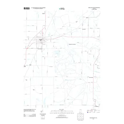
2013 Map of Oakland City
USGS Topo · Published 2013About this map
Oakland City serves as the central hub of this 2013 landscape, where the local street grid intersects with regional transit corridors. The surrounding terrain in Gibson County is defined by the winding course of the S Fork Patoka River and several significant tributaries, including Turkey Cr and Lick Cr. This era shows a complex network of small settlements and named crossroads, such as Dongola, Muren, and Spurgeon, which reflect the region's enduring rural character. Notable water features like Old Lake and New Lake are situated near Gray Junction, while topographical markers like Turkey Hill and Wilson Hill rise above the drainage basins. The map also records industry-adjacent locations such as Enos Corner and Oakland City Junction, providing a detailed look at the infrastructure connecting these southern Indiana communities.
Find a feature on this map
97 named features on this map. Tap any name to fly to it.
Don’t see what you’re looking for? This feature index may not catch every label — zoom into the map to look around manually.
Map Details
Editions of this 2013 Oakland City Map
This is the sole edition of this map. No revisions or reprints were ever made.
Other maps of this area

1900 · De Gonia Springs
USGS Topo · 1:62,500

1902 · Ditney
USGS Topo · 1:125,000

1902 · Degonia Springs
USGS Topo · 1:62,500

1902 · Boonville
USGS Topo · 1:62,500

1903 · Velpen
USGS Topo · 1:62,500

1903 · Petersburg
USGS Topo · 1:62,500

1956 · Vincennes
USGS Topo · 1:250,000

1957 · Vincennes
USGS Topo · 1:250,000

1958 · Vincennes
USGS Topo · 1:250,000
1960 · Folsomville
USGS Topo · 1:24,000