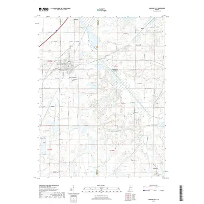
2019 Map of Oakland City
USGS Topo · Published 2019About this map
Oakland City serves as the primary hub of this 2019 survey, situated at the crossroads of E State Rd 64 and major local thoroughfares. The landscape is defined by the winding course of the South Fork Patoka River and its numerous tributaries, including Wheeler Creek and Hurricane Cr, which drain into significant bodies of water like Old Lake and New Lake. This modern topographic record reveals a region with deep roots, evidenced by the numerous family and community burial grounds such as Montgomery Cem and Townsley Cem. Small outlying settlements like Spurgeon and Somerville anchor the southern portions of the map, while the border between Gibson and Pike counties cuts vertically through the drainage basins of Honey Cr. The transition from the town center to the wetlands around Turkey Cr illustrates the persistent relationship between southern Indiana commerce and its river-bottom geography.
Find a feature on this map
91 named features on this map. Tap any name to fly to it.
Don’t see what you’re looking for? This feature index may not catch every label — zoom into the map to look around manually.
Map Details
Editions of this 2019 Oakland City Map
This is the sole edition of this map. No revisions or reprints were ever made.
Other maps of this area

1900 · De Gonia Springs
USGS Topo · 1:62,500

1902 · Ditney
USGS Topo · 1:125,000

1902 · Degonia Springs
USGS Topo · 1:62,500

1902 · Boonville
USGS Topo · 1:62,500

1903 · Velpen
USGS Topo · 1:62,500

1903 · Petersburg
USGS Topo · 1:62,500

1956 · Vincennes
USGS Topo · 1:250,000

1957 · Vincennes
USGS Topo · 1:250,000

1958 · Vincennes
USGS Topo · 1:250,000
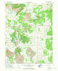
1960 · Folsomville
USGS Topo · 1:24,000