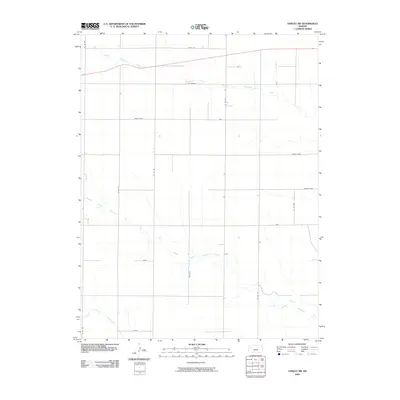
2009 Map of Oakley SW
USGS Topo · Published 2009About this map
North Branch Hackberry Creek and its companion branches define the drainage of this Logan County landscape, where the high plains are segmented by a strictly linear grid of county roads. The settlement pattern is characterized by uniquely named locales such as Eagle Eye and Day Dream in the north, stretching down to Vista in the south. This 2009 survey by the U.S. Geological Survey shows a rural environment where land use is dictated by the hydrological reach of the Middle Branch Hackberry Creek and the South Branch Hackberry Creek. The arrangement of places like Cedar Crst and Broken Bow along these corridors suggests a sparse, ranch-oriented geography typical of the western Kansas plains at the start of the twenty-first century.
Find a feature on this map
18 named features on this map. Tap any name to fly to it.
Don’t see what you’re looking for? This feature index may not catch every label — zoom into the map to look around manually.
Map Details
Editions of this 2009 Oakley SW Map
This is the sole edition of this map. No revisions or reprints were ever made.
Other maps of this area

1954 · Goodland
USGS Topo · 1:250,000

1955 · Scott City
USGS Topo · 1:250,000

1956 · Goodland
USGS Topo · 1:250,000

1957 · Goodland
USGS Topo · 1:250,000

1958 · Scott City
USGS Topo · 1:250,000

1972 · Monument
USGS Topo · 1:24,000

1972 · Winona NE
USGS Topo · 1:24,000

1972 · Elkader NW
USGS Topo · 1:24,000

1972 · Elkader NE
USGS Topo · 1:24,000
1972 · Russell Springs NE
USGS Topo · 1:24,000