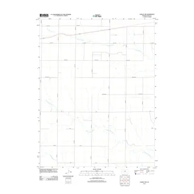
2012 Map of Oakley SW
USGS Topo · Published 2012About this map
N Br Hackberry Cr, Middle Br Hackberry Cr, and S Br Hackberry Cr define the drainage patterns of this Logan County landscape in 2012. The terrain is structured by a rigid grid of local routes, including Co RD-380 and Co RD-390, which connect disparate named areas across the prairie. The map identifies several localized points of interest such as Eagle Eye and Day Dream in the north, and Vista and Wagon to the south. These labels suggest a landscape organized into distinct sections or ranching tracts. Further interior named locales include Cedar Crst, Apache Acre, and Zest, providing a detailed look at the local nomenclature used to navigate this expanse of the High Plains shortly after the turn of the century.
Find a feature on this map
20 named features on this map. Tap any name to fly to it.
Don’t see what you’re looking for? This feature index may not catch every label — zoom into the map to look around manually.
Map Details
Editions of this 2012 Oakley SW Map
This is the sole edition of this map. No revisions or reprints were ever made.
Other maps of this area

1954 · Goodland
USGS Topo · 1:250,000

1955 · Scott City
USGS Topo · 1:250,000

1956 · Goodland
USGS Topo · 1:250,000

1957 · Goodland
USGS Topo · 1:250,000

1958 · Scott City
USGS Topo · 1:250,000

1972 · Monument
USGS Topo · 1:24,000

1972 · Winona NE
USGS Topo · 1:24,000

1972 · Elkader NW
USGS Topo · 1:24,000

1972 · Elkader NE
USGS Topo · 1:24,000
1972 · Russell Springs NE
USGS Topo · 1:24,000