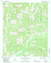
1980 Map of Oakmulgee
USGS Topo · Published 1985About this map
Talladega National Forest dominates this landscape in central Alabama, where the dense woodland of the Oakmulgee District is dissected by a network of drainage systems. The topography is defined by the winding paths of Beaverdam Creek and Oakmulgee Creek, which are fed by numerous smaller tributaries like Holsombeck Creek and Boiling Mill Creek. This area shows a pattern of rural settlement clustered around established houses of worship and small family burial grounds, reflecting the deep-rooted community ties of Perry and Bibb Counties during the late twentieth century.
Find a feature on this map
22 named features on this map. Tap any name to fly to it.
Don’t see what you’re looking for? This feature index may not catch every label — zoom into the map to look around manually.
Map Details
Editions of this 1980 Oakmulgee Map
2 editions found
Other maps of this area

1891 · Clanton
USGS Topo · 1:125,000

1953 · Montgomery
USGS Topo · 1:250,000

1956 · Montgomery
USGS Topo · 1:250,000

1957 · Montgomery
USGS Topo · 1:250,000

1959 · Plantersville
USGS Topo · 1:62,500

1959 · Summerfield
USGS Topo · 1:62,500

1971 · Maplesville West
USGS Topo · 1:24,000
1971 · Randolph
USGS Topo · 1:24,000

1979 · Harrisburg
USGS Topo · 1:24,000
1980 · Centreville East
USGS Topo · 1:24,000