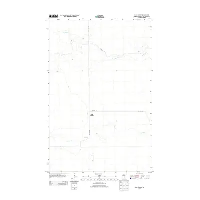
2013 Map of Oaks Corner
USGS Topo · Published 2013About this map
Oaks Corner serves as the central junction for this corner of Lake of the Woods County, where the north-south transit of Faunce Forest Rd meets the lateral path of Rapid River Rd. The landscape is defined by the winding course of the Rapid River and its northern tributary, the N Br Rapid River, which meander through a heavily forested and water-rich terrain. Along these banks, human markers are sparse but significant for local history, notably Peet's Bridge crossing the main channel. To the northeast, the presence of Bankton Cem near Bankton Forest Rd provides a vital point of reference for genealogists tracking early inhabitants of this remote northern Minnesota region. The map illustrates a contemporary view of an area where forest management and waterway navigation remain the primary drivers of land use.
Find a feature on this map
8 named features on this map. Tap any name to fly to it.
Don’t see what you’re looking for? This feature index may not catch every label — zoom into the map to look around manually.
Map Details
Editions of this 2013 Oaks Corner Map
This is the sole edition of this map. No revisions or reprints were ever made.
Other maps of this area
1918 · Winterroad
USGS Topo · 1:62,500
1918 · F
USGS Topo · 1:62,500
1919 · Peppermint Creek
USGS Topo · 1:62,500
1919 · G
USGS Topo · 1:62,500
1943 · Peppermint Creek
USGS Topo · 1:62,500

1954 · Roseau
USGS Topo · 1:250,000

1957 · Roseau
USGS Topo · 1:250,000

1958 · Roseau
USGS Topo · 1:250,000
1968 · Graceton SE
USGS Topo · 1:24,000
1968 · Graceton SW
USGS Topo · 1:24,000