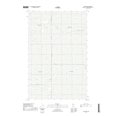
2019 Map of Oaks Corner
USGS Topo · Published 2019About this map
The N Br Rapid River and the Rapid River wind through this heavily forested section of Lake of the Woods County, defining the drainage patterns of a landscape dominated by wetlands and timber. In the northeastern corner, the isolated Bankton Cem stands near the junction of Bankton Trl SW, marking a point of long-standing local history in an otherwise sparsely populated region. The infrastructure is characterized by forest access routes such as Faunce Forest Rd and Rapid River Rd, which facilitate movement across the low-lying terrain.
Find a feature on this map
12 named features on this map. Tap any name to fly to it.
Don’t see what you’re looking for? This feature index may not catch every label — zoom into the map to look around manually.
Map Details
Editions of this 2019 Oaks Corner Map
This is the sole edition of this map. No revisions or reprints were ever made.
Other maps of this area

1918 · Winterroad
USGS Topo · 1:62,500

1918 · F
USGS Topo · 1:62,500

1919 · Peppermint Creek
USGS Topo · 1:62,500

1919 · G
USGS Topo · 1:62,500

1943 · Peppermint Creek
USGS Topo · 1:62,500

1954 · Roseau
USGS Topo · 1:250,000

1957 · Roseau
USGS Topo · 1:250,000

1958 · Roseau
USGS Topo · 1:250,000
1968 · Graceton SE
USGS Topo · 1:24,000
1968 · Graceton SW
USGS Topo · 1:24,000