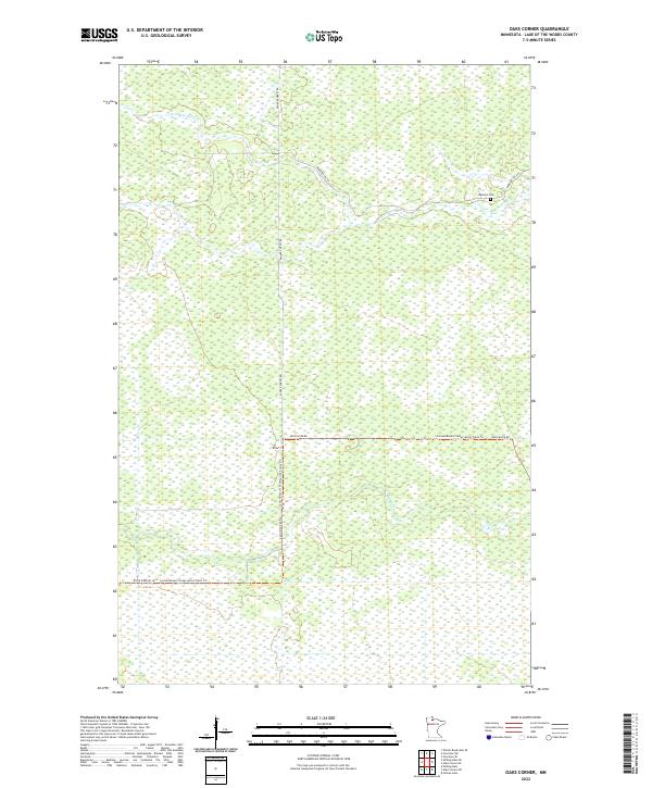
2022 Map of Oaks Corner
USGS Topo · Published 2022About this map
The N Br Rapid River and the main channel of the Rapid River wind through this corner of Lake of the Woods County, defining a landscape dominated by wetlands and conservation land. The presence of the Bankton Cem near the intersection of the Bankton Trl SW suggests an earlier era of homesteading and local settlement within the forest.
Find a feature on this map
12 named features on this map. Tap any name to fly to it.
Don’t see what you’re looking for? This feature index may not catch every label — zoom into the map to look around manually.
Map Details
Editions of this 2022 Oaks Corner Map
This is the sole edition of this map. No revisions or reprints were ever made.
Other maps of this area

1918 · Winterroad
USGS Topo · 1:62,500

1918 · F
USGS Topo · 1:62,500

1919 · Peppermint Creek
USGS Topo · 1:62,500

1919 · G
USGS Topo · 1:62,500

1943 · Peppermint Creek
USGS Topo · 1:62,500

1954 · Roseau
USGS Topo · 1:250,000

1957 · Roseau
USGS Topo · 1:250,000

1958 · Roseau
USGS Topo · 1:250,000
1968 · Graceton SE
USGS Topo · 1:24,000
1968 · Graceton SW
USGS Topo · 1:24,000