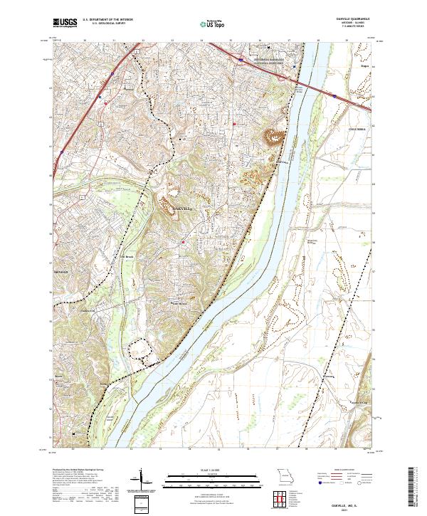
2021 Map of Oakville
USGS Topo · Published 2021About this map
Oakville sits at the confluence of major waterways and transport corridors where the Meramec River joins the Mississippi River. This landscape is defined by its dramatic elevation changes, from the bluffs near Cliff Cave to the broad alluvial plain of the American Bottoms across the state line in Illinois. The map captures a sophisticated suburban and industrial network where Interstate 55 and the Bnsf Railway navigate the terrain alongside historic local landmarks. Evidence of the area's long-standing civic and community presence is found at the Jefferson Barracks National Cemetery and small family-named settlements like Maltese, Wickes, and Flamm City. Large-scale land use is represented by features like the Bussen Quarry Rd, while recreation and local geography are highlighted by Chesley Island and the Lake of the Woods.
Find a feature on this map
46 named features on this map. Tap any name to fly to it.
Don’t see what you’re looking for? This feature index may not catch every label — zoom into the map to look around manually.
Map Details
Editions of this 2021 Oakville Map
This is the sole edition of this map. No revisions or reprints were ever made.
Other maps of this area

1888 · St. Louis
USGS Topo · 1:62,500

1910 · Waterloo
USGS Topo · 1:62,500

1912 · Kimmswick
USGS Topo · 1:62,500

1913 · Waterloo
USGS Topo · 1:62,500

1916 · Kimmswick
USGS Topo · 1:62,500

1933 · Jefferson Barracks
USGS Topo · 1:24,000

1933 · Cahokia
USGS Topo · 1:24,000

1933 · Kirkwood
USGS Topo · 1:24,000

1934 · Cahokia
USGS Topo · 1:24,000
1940 · Cahokia
USGS Topo · 1:24,000