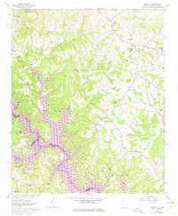
1963 Map of Oakway
USGS Topo · Published 1975About this map
Hartwell Lake dominates the southwestern portion of this landscape, its fingers stretching into the inlets created by the Tugaloo River and Eastanollee Creek. Along the northern and eastern reaches, the community of Oakway serves as a central hub, surrounded by numerous country churches and cemeteries such as Old Retreat Ch and Bethel Cem. The map illustrates a rural society organized around small crossroads like Simpson Store and Knox Store, where local life centered on institutions like the Fair Play-Oakway Sch. The intricate network of small ponds, including Prater Pond and Varnadore Pond, suggests a managed water system for local agriculture and livestock. This 1963 survey, updated with 1972 revisions, provides a clear view of the Oconee County terrain before further modern development altered these traditional settlement patterns.
Find a feature on this map
61 named features on this map. Tap any name to fly to it.
Don’t see what you’re looking for? This feature index may not catch every label — zoom into the map to look around manually.
Map Details
Editions of this 1963 Oakway Map
3 editions found
Other maps of this area

1886 · Walhalla
USGS Topo · 1:125,000

1888 · Pickens
USGS Topo · 1:125,000

1891 · Carnesville
USGS Topo · 1:125,000

1892 · Walhalla
USGS Topo · 1:125,000

1893 · Elberton
USGS Topo · 1:125,000

1894 · Pickens
USGS Topo · 1:125,000

1896 · Walhalla
USGS Topo · 1:125,000

1954 · Greenville
USGS Topo · 1:250,000

1958 · Greenville
USGS Topo · 1:250,000

1958 · Seneca
USGS Topo · 1:24,000