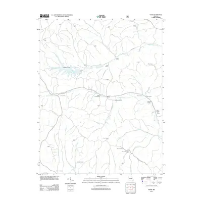
2011 Map of Oates
USGS Topo · Published 2011About this map
Strother Creek and Brushy Creek dominate the drainage of this Reynolds County landscape, where the settlement of Oates serves as a central point along State Hwy J. The area reveals a significant industrial footprint from the mining operations to the northwest, evidenced by the massive Amax Tailing Pond and the Buick Mine Tailings Dam near Cow Mire Hollow.
Find a feature on this map
59 named features on this map. Tap any name to fly to it.
Don’t see what you’re looking for? This feature index may not catch every label — zoom into the map to look around manually.
Map Details
Editions of this 2011 Oates Map
This is the sole edition of this map. No revisions or reprints were ever made.
Other maps of this area

1924 · Edgehill
USGS Topo · 1:62,500

1926 · Edgehill
USGS Topo · 1:62,500

1943 · Lesterville
USGS Topo · 1:62,500

1943 · Boss
USGS Topo · 1:62,500

1944 · Corridon
USGS Topo · 1:62,500

1946 · Lesterville
USGS Topo · 1:62,500

1946 · Boss
USGS Topo · 1:62,500

1947 · Corridon
USGS Topo · 1:62,500

1949 · Rolla
USGS Topo · 1:250,000

1953 · Rolla
USGS Topo · 1:250,000