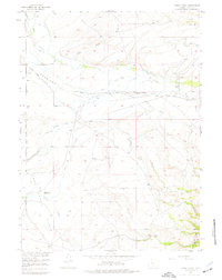
1955 Map of Oberg Ranch
USGS Topo · Published 1977About this map
The Overland Road crosses this high-elevation Wyoming landscape, tracing a historic path through Overland Flats and Lake Creek Flats during the mid-1950s. Water management defines the settlement pattern here, with an intricate network of irrigation channels like the Scribner Ditch, Ault Highline Ditch, and Smiley Ditch supporting remote homesteads. Ranching remains the primary footprint on the land, evidenced by Oberg Ranch and Moore Ranch, while sites like the Old Pennock Place (Aband) and Standard School (Aband) indicate a shift in rural occupancy.
Find a feature on this map
30 named features on this map. Tap any name to fly to it.
Don’t see what you’re looking for? This feature index may not catch every label — zoom into the map to look around manually.
Map Details
Editions of this 1955 Oberg Ranch Map
3 editions found
Other maps of this area

1893 · Fort Steele
USGS Topo · 1:125,000

1939 · Saratoga
USGS Topo · 1:125,000

1954 · Rawlins
USGS Topo · 1:250,000

1955 · Overland
USGS Topo · 1:24,000

1955 · Coal Bank Basin
USGS Topo · 1:24,000

1955 · Oberg Ranch
USGS Topo · 1:24,000

1955 · Meads
USGS Topo · 1:24,000

1955 · Rattlesnake Pass
USGS Topo · 1:24,000

1955 · Coad Mountain
USGS Topo · 1:24,000

1958 · Rawlins
USGS Topo · 1:250,000