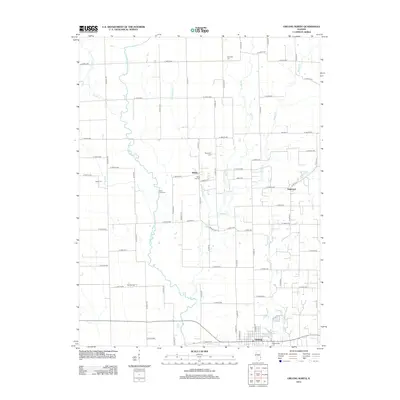
2012 Map of Oblong North
USGS Topo · Published 2012About this map
The N Fork Embarras River winds through this rural Crawford County landscape, defining the agricultural character of the region as it appeared in the early 21st century. The settlement of Oblong anchors the southern edge of the survey, with Oblong Lake and the Oblong Cem nearby. To the north, smaller communities like Kibbie and Dogwood are connected by a precise grid of county roads, including Co HWY-13 and Co HWY-14. Genealogists will find a high concentration of burial sites throughout the townships, such as Harmony Cem, Randolph Cem, and White Oak Cem. The drainage network is particularly dense here, with Willow Cr, Muddy Cr, and No Business Cr cutting through the fields to join the larger river system. This survey documents the persistent rural township structure of Illinois, where small family-named landmarks like Baily Cem and Sand Rock Cem remain prominent features of the land.
Find a feature on this map
49 named features on this map. Tap any name to fly to it.
Don’t see what you’re looking for? This feature index may not catch every label — zoom into the map to look around manually.
Map Details
Editions of this 2012 Oblong North Map
This is the sole edition of this map. No revisions or reprints were ever made.
Other maps of this area

1910 · Hardinville
USGS Topo · 1:62,500

1940 · Greenup
USGS Topo · 1:62,500

1941 · Newton
USGS Topo · 1:62,500

1943 · Greenup
USGS Topo · 1:62,500

1943 · Newton
USGS Topo · 1:62,500

1953 · Indianapolis
USGS Topo · 1:250,000

1956 · Indianapolis
USGS Topo · 1:250,000

1956 · Annapolis
USGS Topo · 1:62,500

1956 · Vincennes
USGS Topo · 1:250,000

1957 · Indianapolis
USGS Topo · 1:250,000