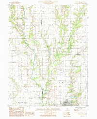
1985 Map of Oblong North
USGS Topo · Published 1985About this map
The North Fork Embarras River winds through the heart of this East-Central Illinois landscape, defining the rural character of the border between Jasper and Crawford Counties. By the mid-1980s, the region shows a complex intersection of traditional agriculture and energy extraction, with numerous Oil Fields interspersed among the creek-bottom lands of Business Creek and Muddy Creek. Small crossroads like Kibbie and Dogwood remain as quiet residential nodes, while the town of Oblong anchors the southeastern corner near Oblong Lake. This survey captures the infrastructure of the era, from the underground pipeline corridors to the Gaging Sta monitoring the river. The map provides a clear record of the townships of Grandville, Licking, Hunt, and Oblong, preserving the placement of local cemeteries and community landmarks during a period of steady Midwestern development.
Find a feature on this map
23 named features on this map. Tap any name to fly to it.
Don’t see what you’re looking for? This feature index may not catch every label — zoom into the map to look around manually.
Map Details
Editions of this 1985 Oblong North Map
This is the sole edition of this map. No revisions or reprints were ever made.
Other maps of this area

1910 · Hardinville
USGS Topo · 1:62,500

1940 · Greenup
USGS Topo · 1:62,500

1941 · Newton
USGS Topo · 1:62,500

1943 · Greenup
USGS Topo · 1:62,500

1943 · Newton
USGS Topo · 1:62,500

1953 · Indianapolis
USGS Topo · 1:250,000

1956 · Indianapolis
USGS Topo · 1:250,000

1956 · Annapolis
USGS Topo · 1:62,500

1956 · Vincennes
USGS Topo · 1:250,000

1957 · Indianapolis
USGS Topo · 1:250,000