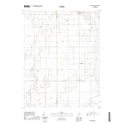
2021 Map of Oblong South
USGS Topo · Published 2021About this map
Oblong and the surrounding Crawford County countryside appear in this contemporary mapping of eastern Illinois. The landscape is defined by its agricultural grid, intersected by natural watercourses such as Big Creek and Hickory Cr. Small, enduring rural centers like Pierceburg and Green Brier anchor the southeastern portion of the sheet, reflecting the long-standing settlement patterns of the region. Local history and genealogy are particularly well-represented through the inclusion of several country cemeteries, including Miller Cem, Saint Valentine Cem, and Yager Cem. These markers of early community life are distributed across the township sections, often near the creeks that once influenced early land selection. The boundary between Jasper Co and Crawford Co runs vertically through the center, marking a significant political and geographical divide in this section of the Prairie State.
Find a feature on this map
59 named features on this map. Tap any name to fly to it.
Don’t see what you’re looking for? This feature index may not catch every label — zoom into the map to look around manually.
Map Details
Editions of this 2021 Oblong South Map
This is the sole edition of this map. No revisions or reprints were ever made.
Other maps of this area

1910 · Hardinville
USGS Topo · 1:62,500

1940 · Greenup
USGS Topo · 1:62,500

1941 · Newton
USGS Topo · 1:62,500

1943 · Greenup
USGS Topo · 1:62,500

1943 · Newton
USGS Topo · 1:62,500

1953 · Indianapolis
USGS Topo · 1:250,000

1956 · Indianapolis
USGS Topo · 1:250,000

1956 · Annapolis
USGS Topo · 1:62,500

1956 · Vincennes
USGS Topo · 1:250,000

1957 · Indianapolis
USGS Topo · 1:250,000